On August 21, 2013, I attended a small-group Lakeview Waterfront Connection Environmental Assessment meeting
Click on image to enlarge it.
At 6:00 pm on August 21, 2013, I attended a meeting at the Long Branch Legion with about eight or nine local Toronto residents and about the same number of officials connected with the Lakeview Waterfront Connection Environmental Assessment project.
I look forward to the large-scale public consultation that will occur early in October 2013.
To view the most recent renderings for the project proposal, click here. For access to other relevant background and planning documents, click here.
I found the August 21, 2013 small-group meeting highly valuable. The discussions were of much interest. The meeting involved the sharing of a wide range of viewpoints.

The meeting was held at the Long Branch Legion near the Long Branch GO Station. I enjoyed seeing this sign outside of the Legion Building. The correct spelling in this case would be Lake Shore Blvd. West instead of lakeshore Blvd. West. Once you travel further west to Mississauga, the spelling changes. At that point, Lake Shore Blvd. West become Lakeshore Road East.
I had the opportunity to acquire a great deal of information, and like other residents at the meeting, had the occasion to express my views.
My views aren’t extensive.
I believe in evidence-based practice, in whatever activity a person engages in.
I think as well that it’s worth underlining, from time to time, that no one individual resident, however forceful, eloquent, or persuasive, represents the essence of a community’s desires. What each resident has to share is highly important, and warrants close consideration.
The Lakeview Waterfront Connection Environmental Assessment project will be sharing an overview of the meeting.
My purpose in this post is to share some immediate reflections.
Sand beach
Among the local residents who was at the meeting was David Switzer of Long Branch.
He remarked after the meeting that some of the information and perspectives that he heard at the presentation and discussion have convinced him to take a fresh look at the question of the sand beach at Marie Curtis Park, within the larger context of the Lakeview Waterfront Connection Environmental Assessment project, and of all of the trade-offs that are involved.
When time permits, in future, I will transcribe a brief interview that I did with David Switzer after the meeting.
The Mississauga-Toronto border ends just west of Applewood Creek
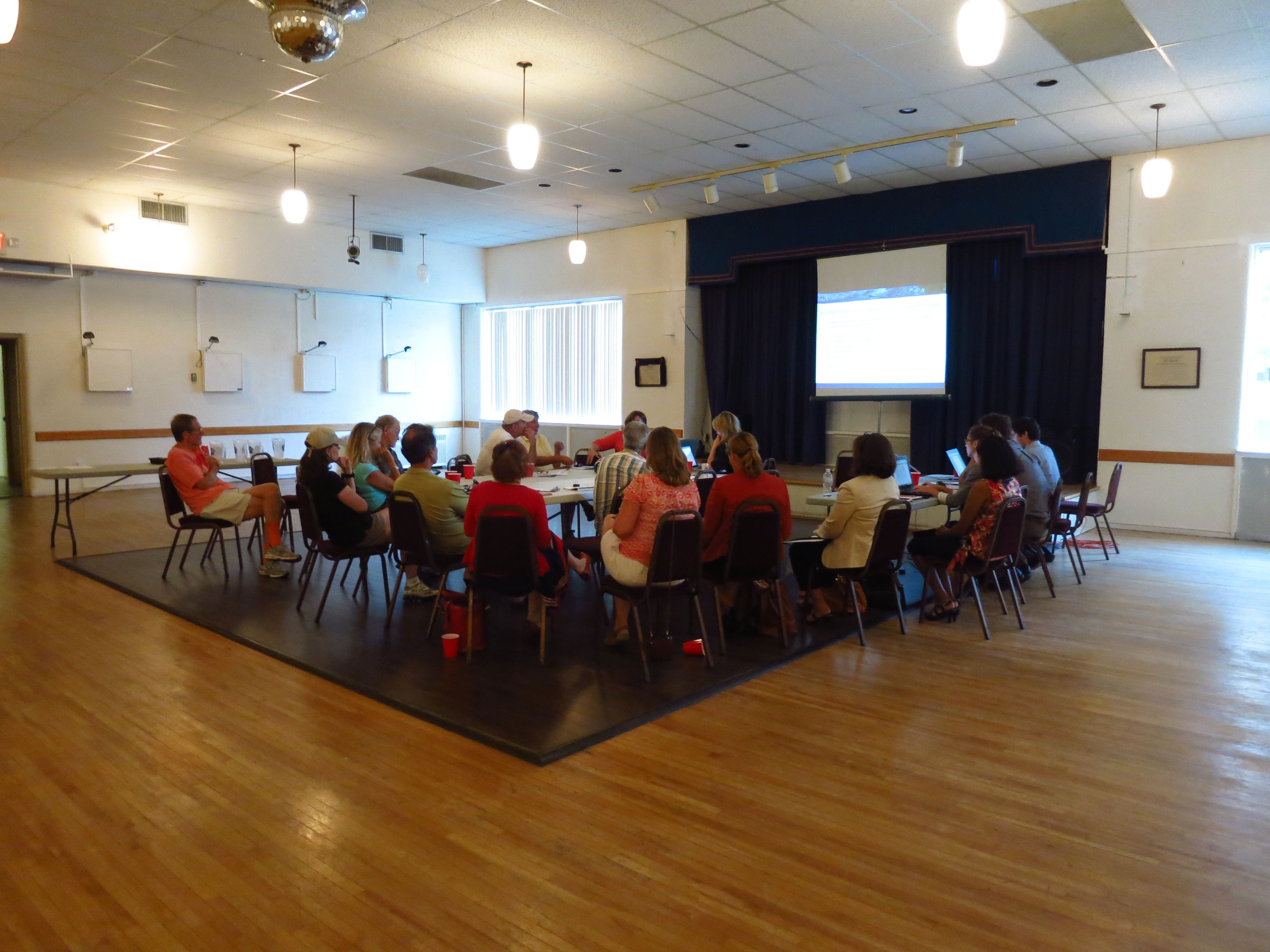
Around 20 people attended the August 21, 2013 meeting at the Long Branch Legion. Jaan Pill photo
A fact at the meeting, that really caught my attention, was the indication – inaccurate, as it has subsequently turned out – that the Mississauga-Toronto border at the shoreline of Lake Ontario actually ends just east of the current location of Applewood Creek, rather than just west of it.
In previous blog posts I had been asserting (correctly, as it turns out: please see following paragraph) that the border ends just west of Applewood Creek.
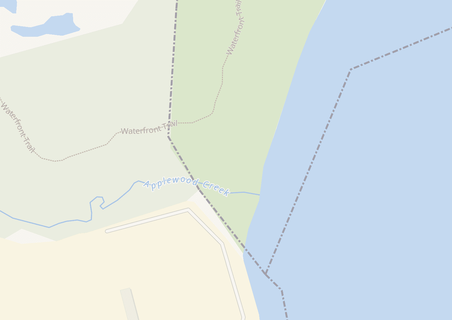
Gosur Map of Ontario indicates that western border between Mississauga and Toronto is located to the west of Applewood Creek.
[I have on March 20, 2019 consulted a Gosur Map of Ontario and have learned that the border is in fact west of Applewood Creek.]

The map at the top left of this photo indicates where the western municipal boundary is located, just west of Applewood Creek. That is, Applewood Creek, in the course of its exit into Lake Ontario, is in Toronto If you click on the image, and then click again, you can get a closer look at map shown at 2013 meeting. The map indicates that the western boundary is west of Applewood Creek. The dotted lines do not in fact represent the western boundary; they serve some other purpose.
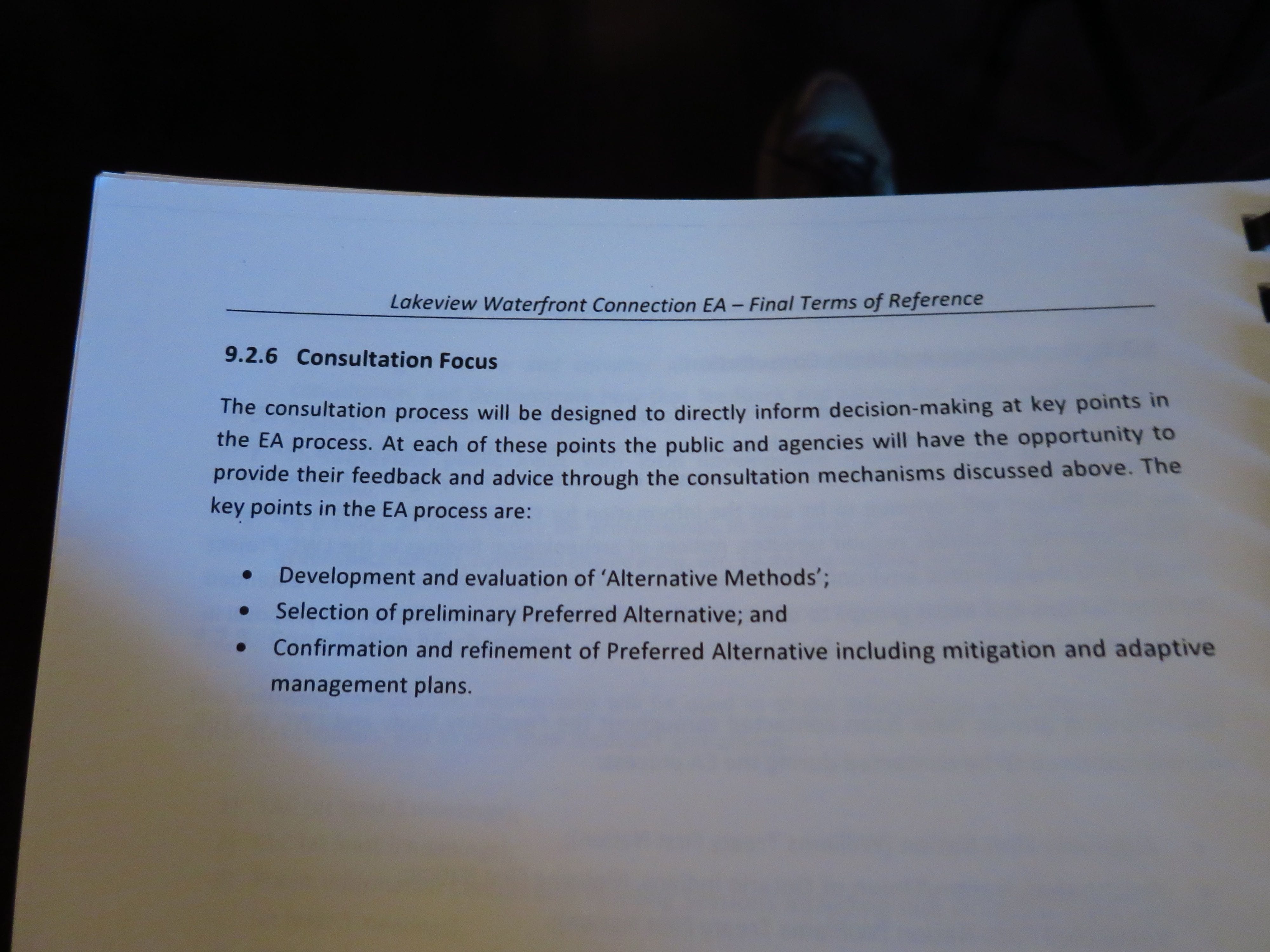
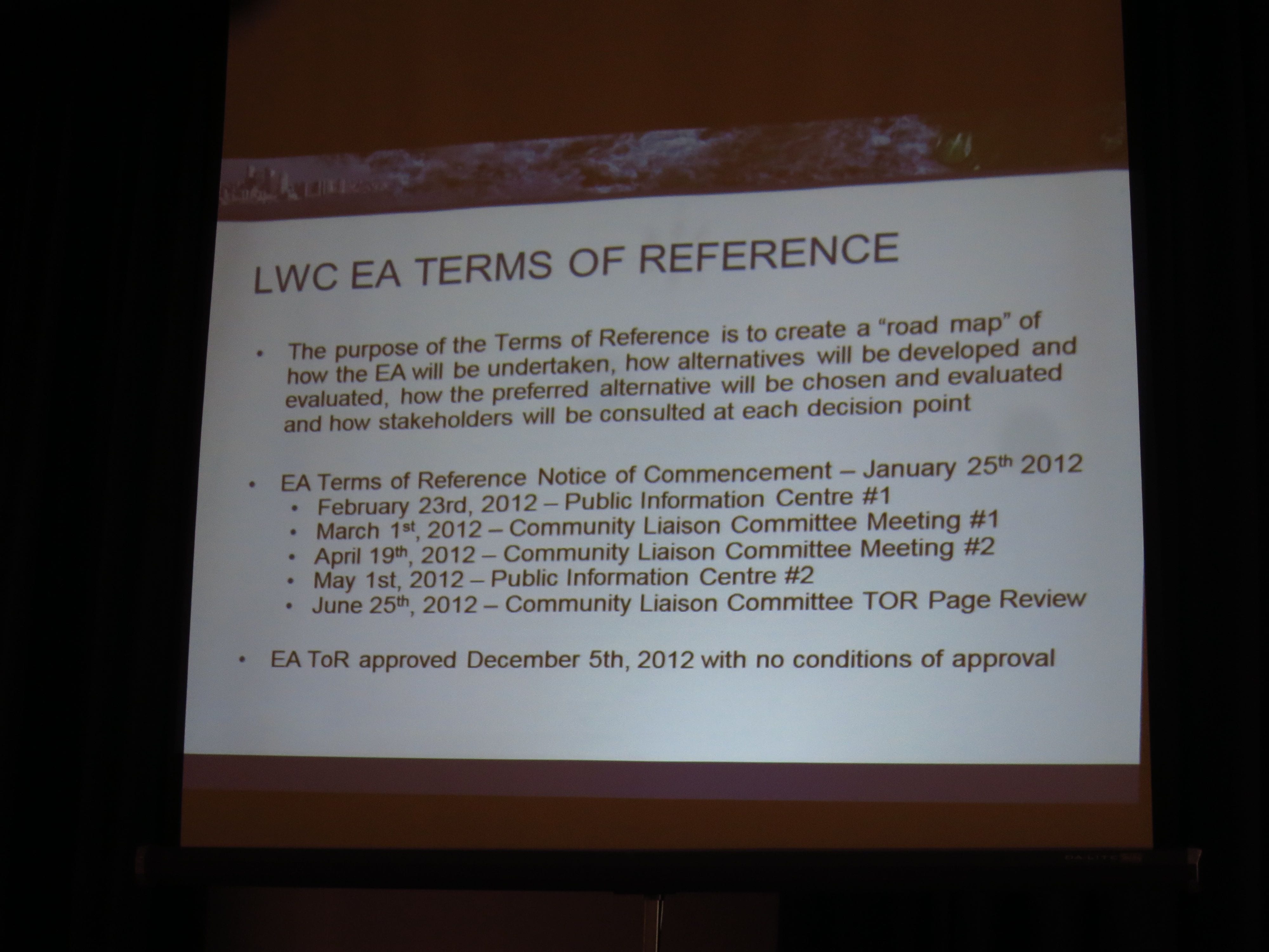
At the outset, the meeting established the context for the Environmental Assessment process, as noted in the last two photos at the bottom of this page. Much ground was covered during the meeting.
The discussion at this and other meetings and consultations will lead to refinement of proposals that will be shared at the public consultations that will take place – and are well worth attending – early in October 2013.
[Update: The anticipated meeting will be late in November 2013. End of Update]

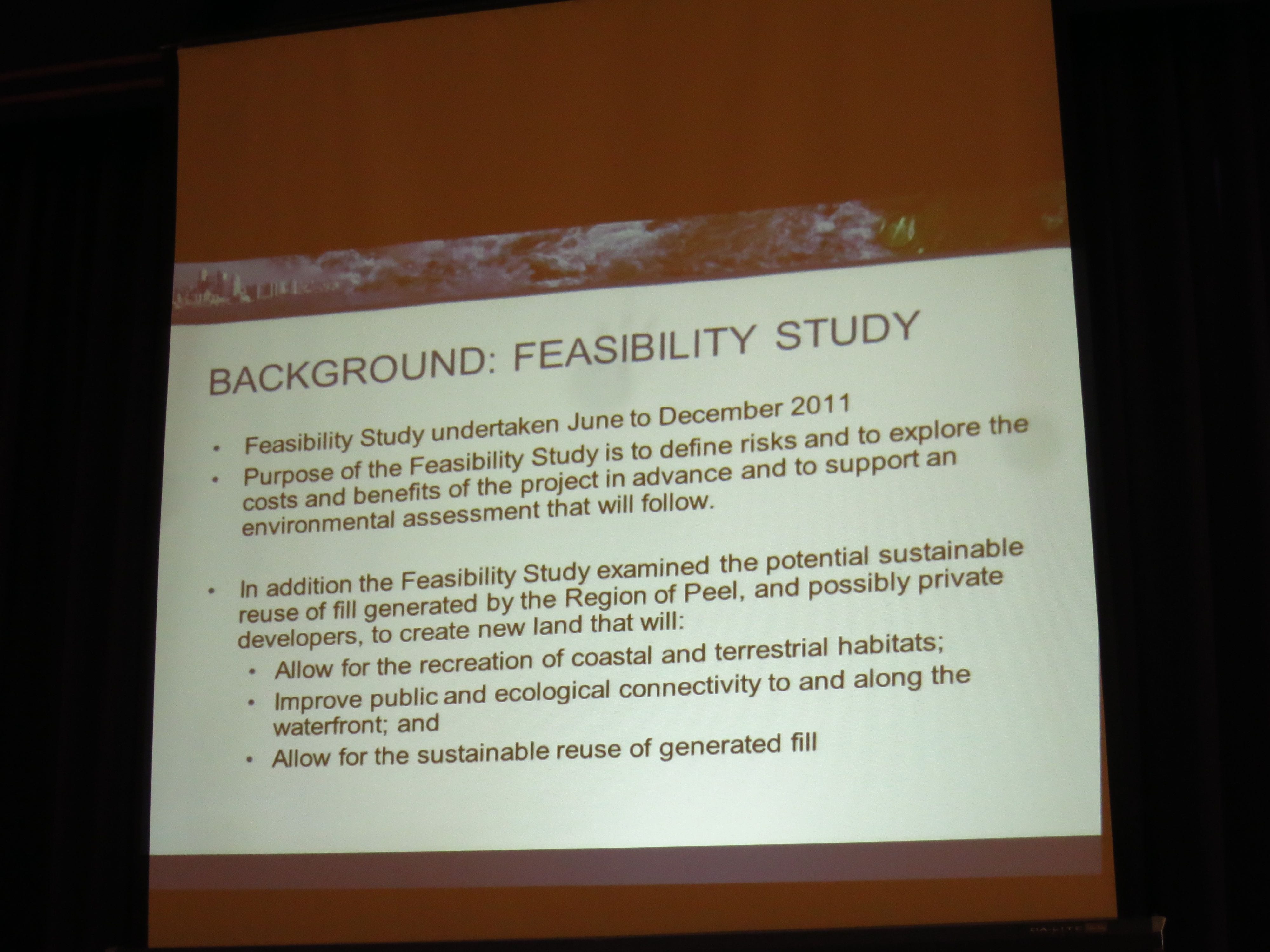
This image provides additional information related to the sand beach.
Click on image to enlarge it. Use the ‘Back’ button on your browser to return to the page you are now reading.
Click on image to enlarge it. Use the ‘Back’ button on your browser to return to the page you are now reading
Leave a Reply
Want to join the discussion?Feel free to contribute!