Pages 2 & 3 of Guidelines Draft: Exmoor Drive above TTC Loop is now included in Long Branch Guidelines project
*

Aerial view from November 1949 looking east along Lake Shore Blvd West from near Long Branch Loop, Ontario Archives Acc 16215, ES1-814, Northway Gestalt Collection. On the left is Exmoor Drive, which extended further to the east in this 1949 view, than it does now, as noted at a post entitled: Life at the Long Branch Army Camp, long, long ago! – Garry Burke shares additional comments. Click on image to enlarge it.
Pages 2 and 3: Character Summary – Feb. 7, 2017 Draft Reference Material
A previous post is entitled:
Advisory Group for Long Branch Urban Design Guidelines had a productive meeting on Feb. 7, 2017
A much earlier (July 2016) post about the Long Branch Guidelines project is entitled:
How to read the streets of Long Branch: Urban Design Guidelines Pilot Project is now underway
At the above-noted July 2016 post, a preliminary map defining the study area for the Guidelines project omits Exmoor Drive (located just north of the Long Branch TTC Loop).
However, the most recent map (pages 2 and 3 from the Feb. 7, 2017 Draft Reference Material) includes Exmoor Drive and Forty Third St.
Including these streets good sense to me. It makes good sense for the Guidelines, when they are completed, to be applicable on Exmoor Drive and Forty Third St., as much as they will be applicable to other Long Branch neighbourhoods.
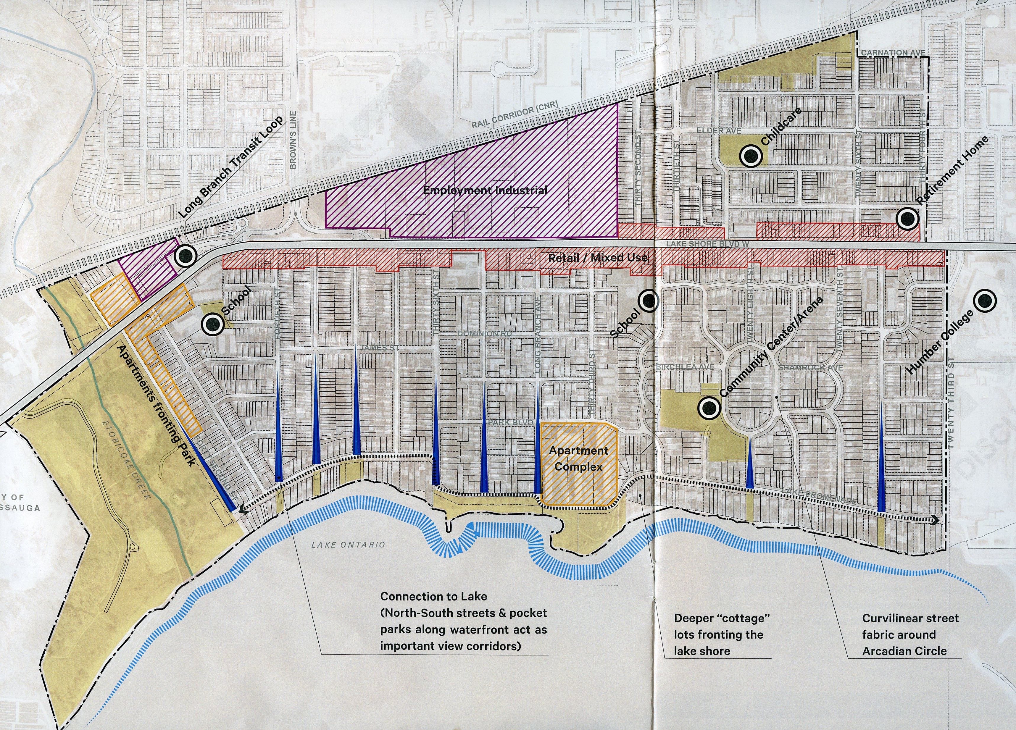
February 2017. Figure 34: Long Branch Character Framework Map. Source: Reference Material published by SvN – Draft [for discussion purposes only]. Reference Material: Character Framework Plan; 5 Key Design Elements. Click on map to enlarge it.
View corridors
I very much like how the lake views – that is, the view corridors looking south toward Lake Ontario, are indicated (in blue) on the map. I also like how the full westward reach of Long Branch (with the border along the shoreline extending almost to Applewood Creek) is accurately represented.
An interesting feature of the lake views is that some are unobstructed, whereas the one at the foot of Fortieth Street has some large rocks placed in front of it.
The lake views originated – as I understand, from research connected with several Jane’s Walks that I’ve organized in Long Branch with Mike James in years past – as access points for the Village of Long Branch fire department. The lake was where the fire trucks would get filled up with water.
I look forward to learning of any archival evidence that would be able to provide a definitive account, of this particular “origin” story.
The rocks that are now in place serve to discourage residents from walking out to the southernmost vantage point, which like all of the lake views on the map, constitutes public property, and in fact is open to any member of the public who seeks to enjoy the view.
It would be of interest to know whether a City-installed traffic barrier (to keep people from driving into the lake) was installed at the terminus of the Fortieth St. view corridor, in previous years. If anybody has photos or recollection, please contact me at jpill@preservedstories.com or through a message at this website.
Long Branch Character Defining Conditions: Draft for discussion purposes only
The following list (below) is from page 3 of the SvN Long Branch Reference Material (Feb. 7, 2016) draft document.
The draft is for discussion purposes only. At the Feb. 7, 2017 Advisory Group meeting, people at the discussion tables made suggestions regarding revision of the draft; the original draft, that was available at the outset of the meeting, reads:
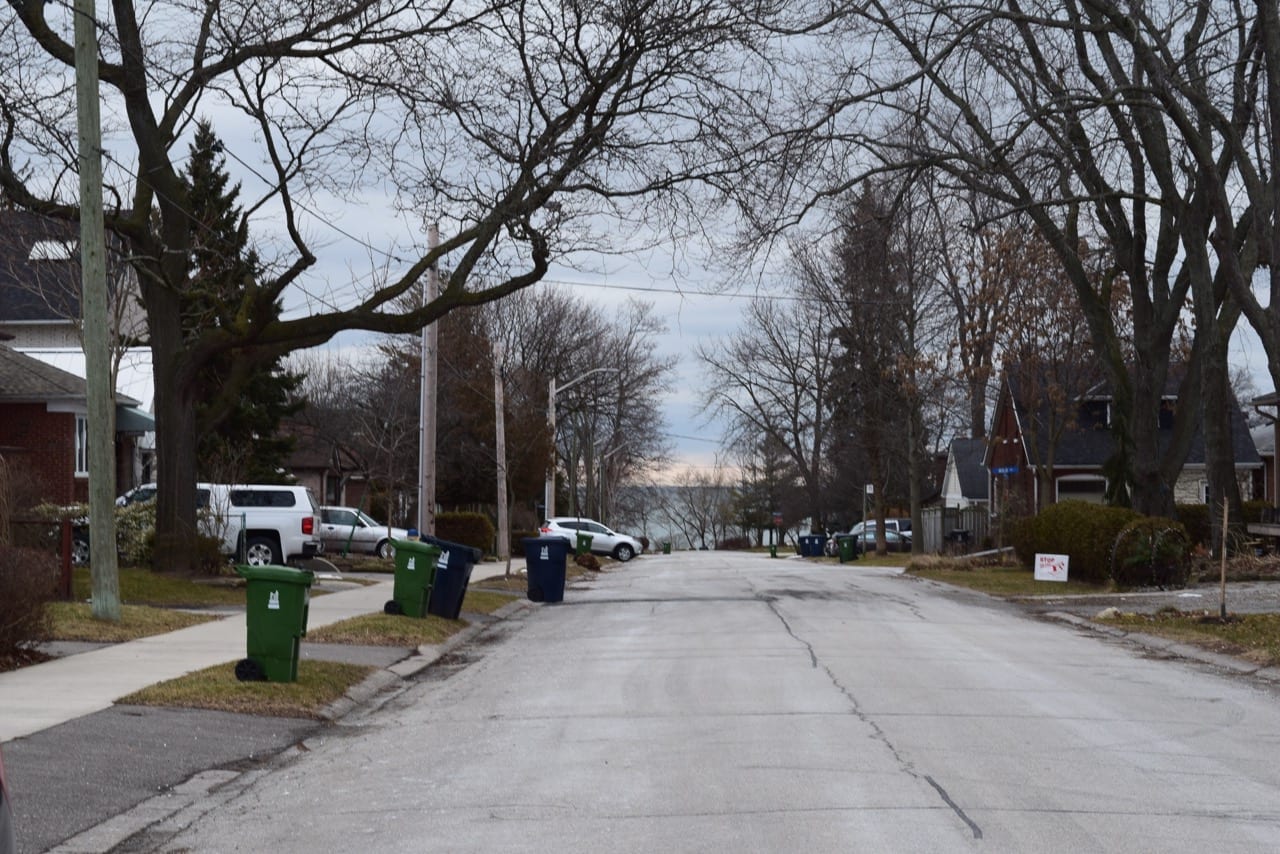
View corridor looking south along Fortieth Street toward Lake Ontario. Jaan Pill photo
a. Historic Long Branch houses dating back to original “villa” lots; predominantly corner lots of distinctive character
b. Houses with predominantly hipped and gabled roofs, often with front porches, and brick and siding clad
c. Generous front/sideyard setbacks buffered by trees and/or hedges on irregular lots or when adjacent to parkettes or other significant open spaces

Large rocks positioned at terminus of Fortieth St. view corridor. Previously, there had been a City-installed traffic sign installed at this location, as I understand, indicating that cars should not proceed past the sign. Jaan Pill photo
d. Predominant 40-50′ lot frontage with generous sideyard setbacks which both provide access to the rear of the lot and establish a street rhythm
e. Significant rear yard open space and tree canopy
f. Isolated apartment blocks are setback generously from the street and adjacent properties, often fronting on to larger open spaces
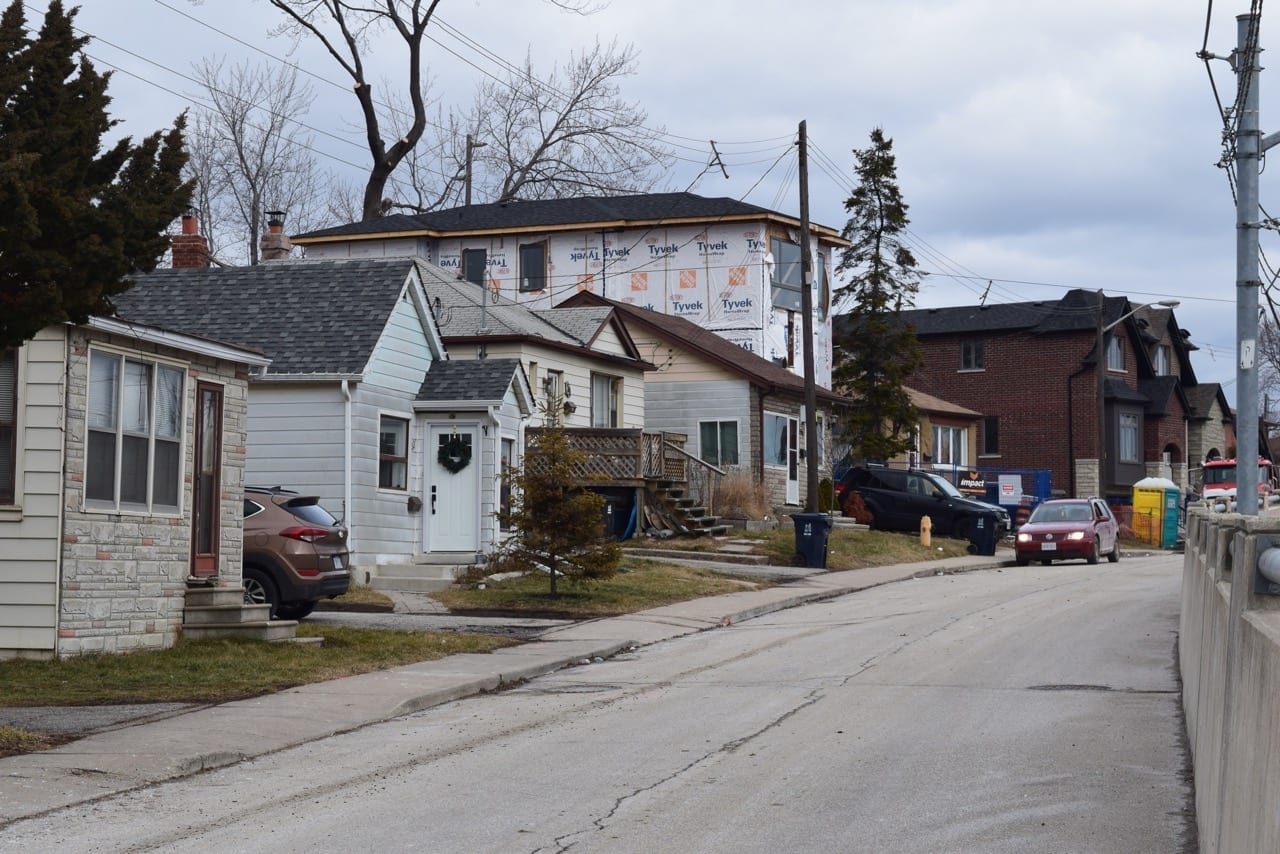
Exmoor Drive. Feb. 8, 2017. Jaan Pill photo
g. Incrementally stepping setbacks following curvilinear street fabric surrounding Arcadian Circle
h. Consistent front yard setbacks and streetwalls along North-South streets which serve as important view corridors from the public realm to the waterfront.
i. Mature tree canopy frames the streetscape and provides shelter, a sense of enclosure as well as invaluable environmental benefits
Exmoor Drive. Feb. 8, 2017. Jaan Pill photo
[End of excerpt from Reference Material draft document]
Original 25-ft lots (along with 40-50-ft lots) dating from Village of Long Branch era
In discussions at our table, it was suggested that, in addition to referring to 40-50′ lot frontages, it’s also apt to refer to the characteristic 25′ lot frontages that are in a category known (if I have the correct terminology) as legal non-conforming.
Such a form of lot frontages – and associated building footprints – date back from the original lot configurations associated with the prewar subdivisions in the Village of Long Branch.
Leave a Reply
Want to join the discussion?Feel free to contribute!