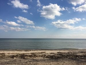
Beach at Marie Curtis Park in Long Branch. The view is from a location to the west of the corner of Lake Promenade and Forty Second Street. Jaan Pill photo.
A previous post is entitled:
Seeking information about the Pleasant Valley Mobile Home Park in Mississauga
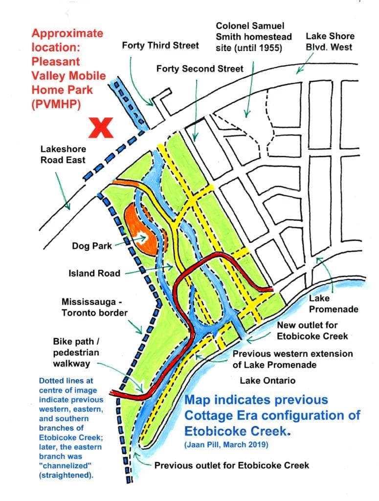
The current post features a map, based on one that I prepared for a Jane’s Walk that Mike James and I organized in 2013.
The map depicts, in a diagrammatic form, the area where a celebrated Cottage Country Paradise was located, in the decades between the First and Second World Wars, at the mouth of Etobicoke Creek along the shoreline of Long Branch in south Etobicoke.
In the next few days, I will post a most interesting and informative paper by Wilfred Laurier University student Laurent Burkhardt.
The paper is entitled: “An Unfinished Timeline: The Pleasant Valley Mobile Home Park Eviction.”
The purpose of the current post is to bring attention to the geographical setting, within which the story of the The Pleasant Valley Mobile Home Park Eviction is located.

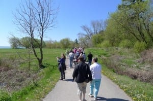
South Long Branch Jane’s Walk, May 6, 2012. In this photo the walk is heading toward the Mississauga-Toronto border, which is based on where Etobicoke Creek used to run before it was channelized. Walk participants received a colour map, printed on cardstock, showing where the two branches of Etobicoke Creek used to run and where the creek used to flow into Lake Ontario. Photo credit: Peter Foley. Click on photo to enlarge it; click again to enlarge it further.
The setting, as the map highlights, is associated with a rich local history, along the Mississauga and Toronto shoreline, which we have had the good fortune to explore in depth (with input from a good number of well-informed people) over many years, at the website you are now visiting.
Details regarding James Street and Forty Third Street
For future maps, the final product will be in higher resolution, once I’ve learned my way around a suitable graphic design software platform. I will also edit some roadway details, taking account of available evidence.
The fact that on the map, the bike path / pedestrian walkway is positioned in the middle, of where the southern branch of Etobicoke Creek used to run, is directly the result of a comment from a long-time resident, who knew the area well in the years before the Second World War.

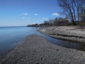
Applewood Creek at Mississauga-Toronto border at Lake Ontario shoreline. The border, as I recently confirmed from an online Gosur.com map of Ontario, is located to the west of the creek. Previously, I was under the mistaken impression that the border was to the east of Applewood Creek. I’ve made corrections, regarding this point, at previous posts. I may still have some corrections, that need to be made. Jaan Pill photo
As well, for a future map I will likely indicate (subject to further research, regarding this detail) that a part of the current version of Island Road is positioned slightly to the west of where it originally ran. It is noteworthy that Island Road retains its name, from the Cottage Country Paradise era.
As well, the map below shows (although it is unlabelled) where Forty Third Street used to run, below Lakeshore Road East, during the previous era.
As well, the map indicates that James Street (which is also unlabelled), which currently terminates at Forty Second Street, used to travel west of Forty Second Street toward Island Road.
If you stand at the current termination of James Street and look toward the west, you will see a clear indentation – a dip in the ground, indicating where a roadway used to run – in the expanse of grass in front of you. That serves as a surviving clue, regarding where James Street used to run.

