With help from Peter Halliday, we’ve located an archival photo of Raimbault Creek near the Back River

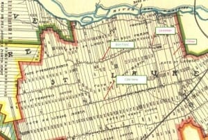
1907 map, which includes an image of Raimbault Creek as it existed at the time. The early map, Tim Hewlings (MCHS '63) notes, is from: A. R. Pinsoneault, Atlas of the Island and city of Montreal and Ile Bizard, s. l., The Atlas Publishing Co., vers 1907 found on the BANQ website.
We owe many thanks to Peter for locating one of the images that we’ve been looking for, as described in a previous post.
Peter Halliday writes:
Bingo! Go here and download photo 10-159. I think it’s exactly what you’re looking for.
[End of message from Peter Halliday]
You can access the image at the link below
For the image that you see below, I’ve converted the file from TIFF to JPEG format, at a lower resolution than the original file.
To access the original TIFF file, go to the following link. It will take some time to open the link, given the size (108 MB) of the file:
http://depot.ville.montreal.qc.ca/vues-aeriennes-1958/VM97-3_02_10-159.TIF
If you click on the photo at the above-noted link, you can get a closer view of the houses and stream.
JPEG version of 1958 Raimbault Creek photo
Below is a JPEG version of the photo. If you click on the photo, and click again, you can get a closer view.

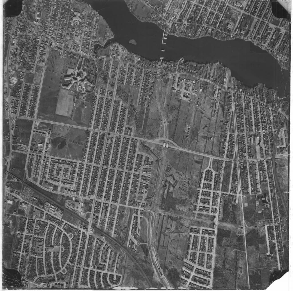
1958 - File VM97, S3, P10-159. This is a 1.3 MB JPEG version of the photo converted from the online 108 MB TIFF version. Credit: Archives of the City of Montreal

A comment about photo 10-159. Looks like Sacre Coeur Hospital in the upper left and just north of it Raimbault Park and a “creek” beside it that’s in 2 sections separated by a “peninsula”, the creek flowing right into the Back River. What are those “things” a bit further down the river? Looks like they could be a couple wharves, one with three prongs on the north shore, the other with one prong on the south shore, plus a “thing” right in the middle of the river between them. These “things” may be the beginnings of the Autoroute Bridge just starting to be built in 1958. Looks like the “bush” has been cleared for the roadway leading to the new bridge. One more comment. The large building complex north of the Sacre Coeur Hospital, situated near the top of the photo and near the river is NOT Belmont Park; it’s a convent called “Soeurs de Miséricorde”.
I have the sense that the items across the river were the part of the bridge infrastructure, as it was being built, for the Autoroute at the point where it crosses the Back River.
Good to know about the “Soeurs de Miséricorde” convent. I was wondering what that building was.
I was interested, some time back, to read about the founding of Cartierville-Ahuntsic. In a previous post, I’ve provided a brief overview:
A Wikipedia reference notes: “Ahuntsic-Cartierville is located in the north end of Montreal, on the banks of the Rivière des Prairies. It traces its history to the fortified Sault-au-Récollet settlement [at the eastern end of Ahuntsic-Cartierville], which was established by the Sulpicians in 1696. This in turn led to the colonization of the area.”
The above-noted link (the second link in the previous paragraph) adds, concerning Sault-au-Récollet, that:
“In 1895, the inauguration of the Sault-au-Récollet tramway line by the Montreal Park & Island Railway Company linked Rivière des Prairies with downtown Montreal and brought significant changes to the area. City dwellers wishing to relax in a rural setting were drawn to the easily accessible locale and wealthy urbanites built opulent homes and summer cottages.”
The community of Long Branch in south Etobicoke in Toronto, where I now live, was originally developed in the late 1800s as a summer resort in a rural setting serving wealthy urbanites from Toronto. The subsequent construction of a radial railway line in the early 1900s from Toronto to Long Branch and beyond brought further development to the area.
The Sulpician order has a close historical connection with Kanehsatake, a connection that set the stage for the Oka crisis. As well, the Sulpician order figured prominently in the political and business career of George-Etienne Cartier, after whom Cartierville was named.
Wikipedia has an brief article on Cartierville which is quite informative. Cartierville was first incorporated as a village in 1906. No doubt before that it was an unincorporated area with the name Cartierville. To quote the article: “Cartierville grew as a suburb when it became in 1898 the north terminus of the Montreal Park and Island Railway tramway line, also known as the “17-Cartierville”. Thus, by 1898, there was a place called Cartierville and a streetcar #17 going to Cartierville. By 1916, Cartierville ceased to exist as a municipal corporation, being annexed that year to the City of Montreal. I was a long time resident of Cartierville. Cartierville was regarded and still is regarded (according to info on the internet*) as having its eastern boundary along O’Brien Bd. Ahuntsic was @ 2 miles to the east, past Bordeaux. The idea of Cartierville & Ahuntsic being linked somehow I think only began when the borough “Ahuntsic-Cartierville” was established in 2002.
*”Cartierville is located in the borough Ahuntsic-Cartierville and is bordered by O’Brien Boulevard, Autoroute Chomedey, Riviere-des-Prairies, and by the southern commuter train line.”[http://www.guidehabitation.ca/blogue/en/tag/ahuntsic-cartierville/]
I’m pleased to know that the railway of the late 1880s and the 17 Streetcar line have a close connection to each other.
The Cartierville neighbourhood, which is part of the borough of Ahuntsic-Cartierville, is indeed currently bordered by O’Brien Boulevard, Autoroute Chomedey, Riviere-des-Prairies, and by the southern commuter train line, as noted at:
http://www.guidehabitation.ca/blogue/en/tag/ahuntsic-cartierville/