The story on the CBC is a gentle one, Graeme Decarie comments

1907 map, which includes an image of Raimbault Creek as it existed at the time. The early map, Tim Hewlings (MCHS ’63) notes, is from: A. R. Pinsoneault, Atlas of the Island and city of Montreal and Ile Bizard, s. l., The Atlas Publishing Co., vers 1907 found on the BANQ website.
In the following Q & A with Graeme Decarie, I’ve added some headings for ease in reading of the text.
Jaan Pill: You worked for CBC and private radio for quite a few years. I would be interested in your comments (for my website) about a recent article by Linden MacIntyre:
Why I Left The CBC And Its Toxic Atmosphere
Early history of Cartierville-Ahuntsic
As well, I would be interested in any comments you may have about the earlier history of Cartierville-Ahuntsic including the role of the Sulpicians in early Canadian history as outlined in a comment at this post:
Another earlier post highlights some of the early history of Cartierville-Ahuntsic:
A Meeting of the People: School Boards and Protestant Communities in Quebec, 1801-1998 (2004)
Graeme Decarie: The story on the CBC is a gentle one. In fact, all the news media of North America have crashed. On the private side, all of them are owned by a handful of billionaires – and they simply publish propaganda for billionaires. That’s true of the New York Times, the Toronto Globe, all of them. In general, private radio isn’t worth a poop, and never has been. It simply can’t afford the number of people it takes to cover even city news.
As for CBC, I was there when it was still in its good years. But it’s quite true that the French side was dominated by separatists who were quite open about their bias, and used the newscasts to broadcast separatist propaganda. On the English side, I got fired for becoming too prominent on the federalist side of the debate. (The CBC has always been vulnerable to political pressure for years.)
CJAD days with Jim Duff
I remember covering a big, anglo rally in my CJAD days with Jim Duff. I was on a balcony of the Sun Life building looking down at Dominion Square where Chretien was speaking. Standing beside me was a sniper of his body guard. A radio carrying French CBC reporting on the rally was somewhere behind me.
It announced its official rally count of some 40,000. And that was simply lying. Every journalist knows that Square holds 80,000 at least – and it was jammed. As well, the streets were jammed for as far as I could see. There were at least a hundred thousand people at that rally. Jim Duff almost exploded when he heard the radio announce the estimate of 40,000.
Cartierville
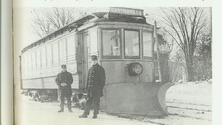
Archival photo of Cartierville streetcar, which Eric Karbin has located online. There was a connection between the original tramway and the 17 Streetcar.
The material on early Cartierville is, to the best of knowledge, quite accurate – and the citation of Margaret Conrad as a source is pretty reliable. (She was in the same MA class as I was.)
The railway did, indeed, have a profound effect on where the rich lived. Until the last days of the 19th century, they lived where they worked, down around St. Jacques St., and gradually moving up the hill to St. Catherine where they built Canada’s Protestant answer to the grandness of Catholic cathedrals – St. James Methodist (now United) church. And beyond that to Sherbrooke St.
Railway
But the railway had destroyed that congregation even before the the church was built. The railway made it possible for the rich to live in a more pastoral area they would call Westmount. There, they bought land from the Decaries who either owned or controlled a vast area stretching west and north all the way to Dorval.
Jean Decarie arrived in 1651 when the population of Montreal was just over 400. When his first son was born, de Maisonneuve was his godfather, and Jeanne Mance his godmother. Then he got a farm in what became The Glen railway yards in NDG where Montreal’s English superhospital was recently built. (The basement of his house was discovered while clearing the polluted soil from the site, and I had a chance to go into the basement for a TV show just before it disappeared into a dump truck.)
Urban expansion
Many of the Decaries became wealthy with urban expansion. While their ancestors were taught by nuns in the old Fort that still stands at the head of Fort St., the newly rich ones could attend expensive private schools which were, and still are, the passport to the upper classes for French Catholics. I might have inherited some of that wealth if my great grandfather had had the wit to marry a nice, French Catholic girl. But the damn fool married a Scots Presbyterian. So I ended up born into a two-room flat in Villeray.
The railway made it possible for some of the very rich to live year round near the water in Cartierville. I believe that Christopher Plummer’s family lived there – as did Sir John Abbot, a prime minister. And those with money still had room left out there for summer cottages.
Oh, one of the Decaries who lived in St. Laurent early in the 1900s, was Reverend Xenon Decarie, who is now being considered for sainthood. I expect the pope will be contacting me for advice.
[End of text from Graeme Decarie]
Updates to recent posts

Photo of Cartierville streetcar that Eric Karbin located online. He notes: ‘I found the picture of a streetcar that went to Cartierville all the way down to Gouin Bd. (before there was a building for the terminus about 100 meters south, situated between Grenet & Ranger Streets). I’m missing the caption that the image had when it was posted on the Belmont Park website (now under construction) but as I recall, it said the photo was taken in 1896. The sign of the streetcar reads: “Around the Mountains, St. Laurent & Cartierville”.’
Further details about the early 1900s polo club (originally called the Back River Club, as I understand) in Saraguay can be accessed here.
Background about the history of polo as a sport can be accessed here and at this post as well.
A website called Montreal Serai features an informative blog post, about the history of Cartierville and adjoining communities, entitled: The rural West Island: Montreal’s lost patrimony.
Additional details regarding the history of Saraguay and St. Laurent – with a particular focus on major roads – is available here.
The related, broader topic of the British empire can be accessed here.
From time to time when I was growing up in Montreal, I learned bits and pieces about Chateauguay, whose role in Canadian history – in particular, as the site of a decisive battle in the War of 1812 – has recently been a source of interest for me.
Marlborough golf club
Graeme Decarie has also shared additional information, as a comment at an earlier post, about the configuration of the caddy shack at Marlborough golf club. He’s also added a comment regarding Miss Keddy.
17 Streetcar
Eric Karbin has shared the following note about the 17 Streetcar, which I remember often taking from Snowdon in the 1950s for the ride to Cartierville.
Eric writes:
In my search for the photo of the #17 streetcar at the end of the line next to Gouin, I found my own comment from 4 years ago at:
http://coolopolis.blogspot.com/2010/03/snowdon-nuther.html
Eric said…
Re: Many people of course remember the 17-Cartierville streetcar as leaving from Snowdon Junction or later from Garland Terminus on its route to Cartierville and Belmont Park. Few realize the route was actually much longer in earlier years.
Comment:
The #17 Cartierville streetcar’s route ended in Cartierville, near (but not at) Belmont Park. Belmont Park (which first opened in in 1923) was about a 5 minute walk from the end of the #17 line. The end of the line was originally (1896) at Gouin Bd & Grenet St. The street car didn’t turn around from here; it simply went in reverse.
In 1925, the end of the line was relocated to the newly built Cartierville Terminus building, on a strip of land lying between Grenet St. and Ranger St., about a 100 yards south of Gouin Bd. #17 streetcars would travel in a loop which went past the terminus. Few realize the #17 had gone further north as far as Gouin Bd.
I lived in Cartierville for years and never realized this until much later when seeing a picture on this website:
http://pages.infinit.net/gautreau/belmonte.html”
Unfortunately, this website [about Belmont Park’s history] is now “under construction” so I can’t find the photo there now. It was taken in 1896.
[End of comment from Eric Karbin]
17 Streetcar from Snowdon to Cartierville in the 1950s
I remember a terminus in Snowdon, where I would get on the 17 Streetcar to get to Cartierville when I was attending events organized by an Estonian church in Snowdon or thereabouts. It’s been about 60 years since I regularly travelled along that route. The area is familiar, in my memory, in the way that some imagined location is familiar because it appears in a person’s recurring dreams.
Much has changed along the route between Snowdon and Cartierville. What remains for me are a few glimpses of visual and other memories of the ride: sunny days, bright colours, a sense of forward progress, the views from the windows. It was a more interesting experience than when travelling by car.
It was a friendly, clunky kind of streetcar. Eventually I would get off the streetcar and walk home. It might have been quite a walk. I did a lot of walking everywhere.
I remember working down in Montreal’s old financial district, on St Francis-Xavier (where the Montreal and Canadian Stock Exchanges were located). I was a runner fo a stock-brokerage company and carried around in a satchel thousands of dollars worth of stock certificates every day, often to the clearing house in the Royal Bank of Canada building at 360 St. James. So I know where the rich people used to work!
I doubt the “railway” had any effect on where these rich people lived – they wouldn’t have taken the streetcar to work. Don’t forget, the streetcar was designed to transport the Masses. Now, the rich people didn’t live on St. Jacques (then known as St. James) back in the late 19th Century. They lived in the Golden Square Mile district of Montreal (bounded by Sherbrooke & Pine, University & Guy).
As far as Protestant Canada’s answer to Notre Dame Cathedral*, I would say it was the Christ Church Cathedral (Anglican) built in 1859 at corner of Ste. Catherine & University. 30 years later, the Methodists built St. James Church a couple blocks to the east. Now I digress. Further east along Ste. Catherine at St. Denis was a Catholic cathedral known as St. Jacques Cathedral; built in 1822, it was THE Roman Catholic cathedral in Montreal from 1825 to 1852. It burned down in 1852. To replace it, another St. James Cathedral (Catholic) was built and consecrated in 1894 at the location where it later became Mary, Queen of the World Cathedral .
*Built mainly in the 1820s, opposite Place d’Armes. It was North America’s largest cathedral for many years
Good to read your comments, Eric.
A good reference with regard to the effect of railway construction in the late 1880s is found at a website called Montreal Serai. The website features an informative blog post, about the history of Cartierville and adjoining communities, entitled: The rural West Island: Montreal’s lost patrimony.
The latter post is well worth reading. I was in particular interested to read that: “The arrival of the railway heralded a revolution in land use in the West Island.”
For your interest, here’s an excerpt from the post (I’ve broken the longer paragraphs into shorter ones, and have added headings, for ease of online reading):
Railway construction
“Hopkins’ maps reveal that by 1879, the Grand Trunk Railway had already sliced through the farms on the southern side of the island from Lachine to Saint Anne-de-Bellevue. Indeed, construction of the railway began in 1853, the very same year in which the seigneurial system was abolished. By 1855 it was complete, and by the end of the nineteenth century the Canadian Pacific Railway had installed a parallel track only a few yards away.
“The arrival of the railway heralded a revolution in land use in the West Island. In 1865, the Montreal lawyer and future prime minister John Abbott purchased a large estate at Senneville. There he built an imposing stone mansion called Boisbriant, after the nearby seigneurial fief of that name which dated back to the end of the seventeenth century.
George Campbell MacDougall
“Abbott appears to be the first wealthy Montrealer to acquire agricultural property in the West Island with the express intention of using it as a country residence during the summer. The trend he established was slow to catch on, however, and fifteen years were to pass before another inhabitant of the Square Mile followed suit.
“In 1880, Grace Brydges, wife of the Montreal stockbroker George Campbell MacDougall, purchased a plot of land on the shore of Rivière-des-Prairies (the Back River) near Cartierville. Soon afterwards the MacDougalls, who were the grandparents of the Mrs Pitfield mentioned above, built a substantial frame house on their property, signalling the decisive establishment of the exclusive summer colony later known as Saraguay.
Saraguay, Dorval and Senneville
“Within a decade, dozens of wealthy Montreal families had adopted the fashion of summering on the West Island lakeshore, with Saraguay, Dorval and Senneville being the most popular resorts. Easy access provided by the railway also opened up places like Pointe-Claire, Beaurepaire and Baie d’Urfe to summer residents. Perhaps the grandest estate of all was Huntlywood, which belonged to the Montreal industrialist Sir George Drummond. It occupied 300 acres of former farmland to the west of St. Charles Boulevard in Beaconsfield.
“After Sir George’s death in 1910 the property was acquired by Sir Hugh Montagu Allan, the Montreal shipowner, who used it as a dairy farm. Renamed Allancroft, the estate survived intact until the 1930s, when the main house was destroyed by fire. Soon afterwards Sir Hugh began disposing of the land. By the middle of the 1950s almost all of it had been built over with suburban housing.
Mass transit
“The spread of mass transit to the West Island was a decisive factor in the destruction of its rural character. In 1913 the Canadian National Railway began ruthlessly cutting through the estates and farms of Saraguay and Pierrefonds to make way for its Deux-Montagnes line.
“In the interwar period, Cartierville Airport was established near the private polo grounds maintained by the inhabitants of Saraguay. At around the same time, construction began on Autoroute 20, just to the north of the former Grand Trunk and CPR tracks, with the intention of relieving the heavy traffic on the lakeshore road leading from Lachine to Sainte Anne-de-Bellevue.
“Finally, in the early 1940s Dorval Airport came into being, its runways radiating into the farmland of several adjacent parishes.”
[End of excerpt]
After that came the suburbs, such as all the great little postwar houses that were lined up along the street that I lived on, namely Lavigne Street between de Salaberry and Forbes.
I knew Christopher Plummer had some sort of Montreal connection. I believe he was a member of the Montreal Repertory Theater that was located at the top of Mount Royal back in the ‘50s and earlier. But I have grave doubts, in fact I know, he never lived near the water in Cartierville. Ditto Sir John Abbott (the PM of Canada at one time). But Wikipedia throws some light on all this. Plummer [who happens to be the great grand-son of Sir John] lived at the Abbott family home in Senneville, QC after his parents divorced when he was quite young. Senneville, being situated at the western tip of the Island of Montreal, is about 15 miles from Cartierville.
I doubt the railway to Cartierville (CNR) had anything to do with rich people locating their mansions in Saraguay, once a part of Cartierville.
A rail line was built by the CPR (or maybe it was Grand Trunk) from Windsor Station in Montreal to the West Island (Ste. Anne de Bellevue) many years ago, would you believe 1854? I rode that train only once in my lifetime (about 150 years later) – to get to Hudson and then (by bus) to Oka, to pay a visit to the monastery there and buy some excellent chocolate and cheese. I don’t know if millionaires actually commuted from their Senneville mansions/summer cottages to their high paying jobs in Montreal at any time using the train. But I guess it’s possible.
Ditto for rich train commuters between Westmount and Windsor Station. Why wouldn’t they have their chauffeurs drive them in a Bentley or something?
The important thing, I would say, is to assess the evidence, to take into account the historical record.
My own task, as I consider these topics, is to get better acquainted with what historians, who specialize in the study of Canadian history, including local history as it relates to Cartierville and the West Island, have discovered about these questions. What I’ve heard to date has been most interesting, and I look forward to learning much more.
The blog post “The Rural West Island” at Montreal Serai looks interesting but I note that one statement is somewhat dubious: “By the middle of the eighteenth century, the villages of Sainte-Geneviève, Sainte-Anne-de-Bellevue, Pointe-Claire, Dorval, Lachine, and Saint-Laurent were all well-established”. That should probably read: “By the middle of the nineteenth century…”
That is an interesting question. Dorval’s history dates back to 1665. Ahuntsic-Cartierville’s history dates back to 1696. Saint-Laurent was founded as the Parish of Saint-Laurent in 1720.
Those are three of the villages that I’ve looked up quickly online. I have the impression that the villages may have been established by the middle of the eighteenth century. At this point that’s my best guess. I would have to delve into the matter further, before I could say for sure.
I don’t claim to be a professional historian but I do question whether the evidence I am aware of completely supports what George Vassiadis has to say about the West Island. I question a few things he has to say but can’t say I question most of what he says because a lot of it is simply something I know nothing about. He says: “The historical boundaries of the rural West Island include all of present-day …. the Saraguay district of Montreal and the part of Saint-Laurent west of Boulevard Toupin.” He cites no evidence for this. It astouns me to hear someone claiming Saraguay was once part of the West Island. West Of What? St. Lawrence Blvd, the dividing line between east and west Gouin Bd? That would mean Cartierville and part of Ahuntsic are included in what once was part of the rural West island, which is nonsense! He says: “ In the interwar period, Cartierville Airport was established near the private polo grounds maintained by the inhabitants of Saraguay”. The Wikipedia article on Cartierville Airport says it was in existence in 1911 (before WWI) under the name Bois-Franc Field; and that before it was an airfield it was the site of the Bois-Franc Polo Grounds. This suggests that the private polo grounds mentioned by Vassiadis were something different from the polo grounds which the Wikipedia article mentions. Where’s the evidence there were two polo grounds in the same area, one where the airfield was built and one which he says was built near the airport? He says: “By the middle of the eighteenth century, the villages of … Saint-Laurent were all well-established.” Well, I agree that 1720 (the year the Parish of St. Laurent was founded) is the middle of the eighteenth century but are the parish and the village the same thing. No evidence so far that they were, right from the start.
Ahuntsic-Cartierville’s history doesn’t date back to 1696; it dates back to 2002 when “Ahuntsic- Cartierville” was created as a borough of Montreal. The hyphen “-” is misleading because really the two former villages or cities were separate, historically and corporately.
These are interesting comments, Eric.
Whether Ahuntsic-Cartierville’s history dates back to 1696 or 2002 is for each person, who encounters the available online statements, to decide.
I am certain that any professional historian’s conclusions, based as they are on the study of primary and secondary sources, are subject to contention.
I think the value of information put forward by trained historians such as George Vassiadis is that such information opens up conversations – concerning the veracity of the information, among other things.
I’m keen to know if there are historical societies set up in the former villages of Cartierville, Dorval, Saraguay, and the like, and if there are published or unpublished memoirs around written by people who lived in these communities years ago.
In my own community of Long Branch (Toronto), we have a historical society but it’s currently in a state of hibernation. I anticipate that in one or two generations it may become active again. In my own case, as a person interested in local history, I’ve interviewed many people, now in their eighties or nineties, who grew up in the area. I’ve posted some highlights from the interviews at my website. In time, if all works out, I will have edited video versions of these interviews available, with video and transcript highlights posted online.
The key thing, I find, is that sharing of information about local history opens up conversations. Blog posts that I’ve written in the past about Long Branch have led to many conversations – online conversations when people send in their interesting thoughts and recollections about childhoods spent in the community and in local schools 60 years ago, or details about buildings long gone, or anecdotes about what happened long ago.
I much enjoy such conversations. For the past three years I’ve worked with a friend to organize Jane’s Walk in our local community, the first week of May each year. We stage walking conversations where we set up a route and we talk about local history, stopping at key points along the way to share what we know. We also invite people who know the area to share their stories. It takes a bit of work to organize such walks, and to make them work really well, but it’s something I really enjoy. There’s so much we can learn from each other, just by having the opportunity to get together and compare notes about the communities where we live, or where we have lived in the past.
Here’s a link to map (Hopkins, 1879) of Parish Of St. Laurent:
http://images.banq.qc.ca/erez4/download/174244_098_ce014666763d050.zipu
I see names of land owners that ring a bell with me:
O’Brien, Jasmin, Decary, Cousineau, Laurin, Tolhurst.
There’s a creek shown flowing into R. des Prairies. It goes through properties of A Boa (33,34) and M Leonard (29). Could be Raimbault Creek. I tried to follow the creek south to its source and got lost somewhere in Cote des Neiges. There’s a railway on the map called “Quebec Montreal Ottawa and Occidental Railway” It looks like it follows the same right-of way that the CPR train went along later to go from Downtown Montreal, past Bordeaux and north to Ste. Agathe.
Most interesting. I was wondering where the street names came from.
I can’t open the map link. Can you send it to me as an email?
I’ve made a start with this map:
http://www.mcgill.ca/library/files/library/hopkinsindex3.pdf
That’s cool.
I thought history was supposed to be the telling of the truth about the past. If someone’s history says one thing and someone else’s says something else, obviously they can’t be both telling the truth.
I don’t know of an historical societies specifically relating to Cartierville, Saraguay, etc. That would be interesting if there were any, past or present or hibernating. But I do know of a historical relating to Chateauguay, called the Chateauguay Valley Historical Society. It is an active association formed in 1961. Check it out at
Chateauguay Valley Historical Society
Personally, I don’t go in for organized formal gatherings and discussions about local history. But I do enjoy informally trading comments with anyone who has some ties with whatever local area we’re talking about. Sometimes we agree on what happened long ago; sometimes we don’t but that’s okay by me.
That link I sent to the Hopkins map doesn’t work for me either, but there‘s another way to get to that map because I got to the map that other way. Due to infonesia, I have forgotten that other way but I think I googled “Parish of St.Laurent” and clicked one of the results.
I am very pleased to know about the Chateauguay Valley Historical Society.
I am very impressed with what is written at the above-noted link. This looks to me like a well organized historical society, doing great work in preserving local and regional history.
I’ve notice that St. Williams, Ontario, in another part of Canada, has also done a commendable job of preserving local history.
I’m pleased there are quite a few places that have been successful in preserving stories related to local history. Such stories – along with the preservation of cultural landscapes and buildings (any place in the world) that have heritage value – add so much value to the lives of local residents and visitors.
Here’s how to access the 1879 Hopkins map –
1) go to images.banq.qc.ca website
2) search “Hopkins 1879”
3) click #3 in the search results [List of useful maps for research on the city of Montréal ]
4) go down list of maps to 1879, then click on link in the “Call number” column on right
5) that will bring up a 4 page collection of images of the 1879 Hopkins map
6) go to page 3 and click on image 098
7) that will bring up map of the Parish of St. Laurent.
It’s great to know the steps, Eric, to find the map.
I don’t know much about history. I’d say that historians can more readily agree on what the evidence is – what the primary sources are. How the sources are interpreted is another matter.
My sense is that each generation arrives at its own version of the truth about the past, and about the present moment. I think as well that there is a borderland between what we call fiction and what we call non-fiction. This applies to history as it applies to any narrative. That’s my view of things. I have a Category at this website called Historiography where I explore history as I understand it.
Similarly I have a separate Category for Military history. I began reading about military history after I heard a talk about the history of the police services in my local community. It soon dawned on me that the history of policing has a relationship to military history.
My own knowledge about history or any other topic is limited. I’m always trying to learn a little more. On all levels, I am a beginner. I approach sense making from the perspective of symbolic interactionism, a topic I have explored at length at my website. I find value in learning other people’s views. For that reason, I enjoy knowing your own views about what history is, and what conclusions one can read with regard to it.
Here’s another point I’d like to make about George Vassiadis’ remark that by the middle of the eighteenth century the village of St. Laurent was well-established and your remark that the parish of St. Laurent was founded in 1720.I see no evidence cited by him or you for these remarks.[I agree with your remark because I found corroboration for it . But your remark does not support the Vassiadis remark.].It was not until 1845 that St. Laurent was incorporated as Ville St. Laurent. Don’t take my word for it. Check anywhere. Prior to that time, the only organized local entity bearing the name St. Laurent appears to be the Parish. The map of that parish clearly indicates that the parish is not a village, as the word “village” is commonly understood. So what the historian, George Vassiadis, bases his above statement on seems to be the complete absence of any primary evidence or secondary for that matter.
It was not until 1893 that Ville St. Laurent came into existence. In 1845, the municipality of the Parish of Saint Laurent was created. But don’t take my word for it. Check the evidence.
I agree. The assertion that the Parish of Saint-Laurent was founded in 1720 requires evidence to back it up. The task would be to find historic accounts of the early years of Saint-Laurent.
Here’s some evidence. In 1720 (September 20) Canonic erection of the Saint-Laurent Parish. François Seré becomes the first parish priest. I don’t think there is any serious question that the Parish of Saint Laurent was founded in 1720. The real question is: was the village of Saint Laurent well-established by the middle of the eighteenth century? I’d say: Nay. Here’s some evidence to support that answer:
-1845 (July 1) Creation of the legal structure for the municipality of Saint-Laurent Parish
-1855 The United Canada Parliament abolishes the seigniorial regime in favour of a municipal regime. A section of the Saint-Laurent Parish territory consists of a civic municipality, and Dr François-Zéphirin Tassé becomes the first Mayor. Parish Council holds its first meeting on July 25.
-1893 (February 27) Incorporation of a parcel of land owned by the Saint-Laurent Parish. La Corporation de la Ville de Saint-Laurent is created and City Council holds its first meeting on April 25, 1893.
I’m not doing any more research on this subject until I get some sort evidence suggesting they may have been a village in the Parish of Saint Laurent sometime in the eighteenth century.
This is good information. At this point, as I understand, the question is whether or not the reference to the middle of the eighteenth century was an error on the writer’s part, at the overview about the West Island that we’ve been discussing. On this question, whatever the evidence says is what’s of particular interest to me. Wherever the evidence (solid and corroborated evidence, presented within a frame of reference that appears as well to be cogent) leads, that’s where I like to go. That’s what I like to go with.
As a followup to this most interesting discussion, I’ve asked Graeme Decarie for his reflection regarding these topics. After he taught at Malcolm Campbell High School, he went back to school for his MA and PhD in history and began teaching history at the university level. I’ve posted a Q & A with him, about the early history of Cartierville, as a separate blog post:
Q & A with Graeme Decarie regarding the history of Cartierville
I’ve learned so much more about the history of Cartierville and St. Laurent, as a result of the discussions that we’ve had over the past week.
It seems to me that the historian made an error. There is no evidence to back up this historian’s statement. Evidence, solid and corroborated, presented in a cogent frame of reference, does not exist that shows beyond a shadow of a doubt that there was no village within the boundaries of the Parish of Saint Laurent during the eighteenth century. But then, neither does such evidence exist that shows a village did exist at that time. It appears that you would like to go with something that does not exist. There is some evidence that suggests that it wasn’t until the nineteenth century that a village began to exist within the territory of the Parish of Saint Laurent. This evidence is in the form of statements found in municipal archives websites that suggest that during the eighteenth century the Parish of Saint Laurent was rural and agricultural and that only in the nineteenth century did village type buildings come into being there.
e.g. (1)- L’ancien village de Saint-Laurent
you’ll find this concerning a “secteur” called “L’ancien village de Saint-Laurent”:
“1663-1844. À cette époque, le secteur fait partie d’une terre agricole.
1845-1945. Des auberges, des hôtels et des commerces s’installent dans le village”
(2)- Saint-Laurent Parish and Church
“With the advent of the parish system introduced by Mgr de Saint-Vallier, on September 20, 1720, the residents of Coste Saint-Laurent attended the canonic erection of their parish, which was entirely rural.” [Coste=Parish]
This latter statement indicates that as of 1720, the Parish of Saint Laurent was ENTIRELY RURAL. It would not be ENTIRELY RURAL if it contained a village. Of course, a village could have shortly afterwards sprung up, within the middle of the eighteenth century, but there appears to be no evidence of that occurring. If that evidence ever appears, I’ll bet dollars to donuts it’s entirely fabricated.
Your comments have added much to my understanding of the history of St. Laurent. I’m pleased to say that Graeme Decarie has also added his own comments, presented as a Q & A at a separate recent blog post:
Q & A with Graeme Decarie regarding the history of Cartierville and Ville St. Laurent
Jaan, when did the Saint Laurent “suburb” come into being”? According to your post on Nov 24, 2014,
“After that came the suburbs, such as all the great little postwar houses that were lined up along the street that I lived on, namely Lavigne Street between de Salaberry and Forbes”. In this context, “after that” seems to refer to a preceding paragraph which says “Finally, in the early 1940s Dorval Airport came into being…”.
According to another post you made on Sept 17, 2016, “when Montreal grew beyond its original boundaries (the boundaries being a walled fortification), one of the suburbs that developed on a road leading north of the walls was the Saint-Laurent suburb.” In this context, it seems that it was in the 18th Cent that the suburb of Saint Laurent developed. Your post also refers to a book written in 2007 that apparently draws a distinction between Saint-Laurent (the suburb) and Saint-Laurent (the ward). You quote from the book which refers to Saint Laurent suburbs in 1792 and earlier, 1761.
Your quote also gets into the 19th Cent: “ The trend continued: the suburbs especially grew and in 1825 contained a little over three quarters of the population. The biggest were the suburbs of Saint-Laurent …In 1831, the government divided the area into wards for the first time, and then redivided it in 1840 and, in particular, in 1845. As of 1845, Montreal had nine wards …[including] Saint Laurent]. The book also refers to a 1914 map which shows Montreal circa 1761 and, north of the walls of Montreal, an area called “Faubourg Saint Laurent”.
This area is located in the “Prairies” and appears to have roads including St. Louis and St Baptiste. This area also appears to be just north of a small river that runs parallel to the north walls of Montreal. “Faubourg Saint Laurent” on this map appear to me to be referring to an area that is quite different and distant from what later became Ville Saint Laurent.
The map shows streets in Old Montreal like St. Jacques, St Francois Xavier and Notre Dame. I worked in this area at a stock brokerage firm in the ‘60s located at the corner of St. Francois Xavier and Notre Dame. The map also shows the location of the famous Place D’Armes. I believe that the Saint Laurent Ward is quite different from what became Ville Saint Laurent – this Ward was not far from Old Montreal and became part of Downtown Montreal. If this ward was ever a “suburb”, it ceased to be so long ago. What became Ville Saint Laurent was out in the boonies, close to Riviere des Prairies and next to Cartierviile. Parts of what became Ville Saint Laurent still continue to be suburbs of Montreal.
The little ”postwar” houses were built to house families of workers at the nearby aircraft plant (Canadair). They may have been built during the war. My sister lived for a while in one of these houses located on Bois Franc Road. She lived in the suburbs in Ville Saint Laurent.
The next question is one that was discussed 2 years ago on preservedstories but never really resolved: “Was the village of Saint Laurent well established by the middle of the 18th Century?”. This question involves the matter of defining what a “village” is and what does “well established” mean. From what I can ascertain, the Parish of Saint Laurent [which was established in 1720] did not, 30 years later, contain a village according to a normal dictionary definition of “village”. The Parish probably consisted of a large area of about 30-50 farms. The only building in the Parish that was not located on a farm was the Church. How do I know? I don’t but that’s my guess based on information from the http://www2.ville.montreal.qc.ca/; http://upsaintlaurent.org/.
In the 17th Century, territory designated “Saint Laurent” did not yet exist. However, in 1687, Jean Descaries died. He happened to have owned a lot of land on the Island of Montreal. At his death, his sons Paul, Michel and Louis inherited his land and continued to clear (as colonizers) the Coste Saint-Michel (future Coste Saint-Laurent).
“Coste Saint-Laurent” came into existence in the early years of the 18th Century, circa 1702, as a result of a land grant referring to the “Coste Saint-Laurent”.
In 1718, the inhabitants of “Coste Saint-Laurent” made a petition to the Catholic
Church.
In 1720, the Parish of Saint Laurent came into existence, as part of a new parish system that describes territorial boundaries of local areas in New France. In 1722, the Parish of Saint-Laurent” had 29 homes. At some point, the term “Coste” is no longer used to designate the ”Parish” of “Saint-Laurent”.
For the next hundred years or so, well into the 19th Century, local government in the Parish of Saint Laurent was mainly a matter of deciding where to build a church and raising money by taxes to pay for it.
In 1845, part of the Parish of Saint-Laurent was made into a legal municipality by the government of Lower Canada.
It is not until 1855, that this new municipality elected its first mayor, Dr. François-Zéphirin Tassé.
In 1860, the stone industry, the oldest industry in Saint-Laurent, began operations.
In 1861, there was a school in Saint Laurent called “Academie Industrielle”. That year it became College de Saint Laurent.
The foregoing suggests a village was well established but it’s the 19th century.
In 1893,La Corporation de la Ville de Saint-Laurent is created and City Council holds its first meeting on April 25, 1893. The newly created Ville de Saint Laurent was a parcel of land owned by the Saint-Laurent Parish.
There’s more history of Ville Saint Laurent at http://www2.ville.montreal.qc.ca/ that suggests that the Ville de Saint Laurent was the first Saint Laurent suburb, basically a 20th century phenomenon.
I read your comments with much interest, Eric.
I have broken your text (above) into shorter paragraphs, for ease of online reading. I trust that is okay with you.
I agree with you: “Faubourg Saint Laurent” on the map does appear to refer to an area that is quite different and distant from what later became Ville Saint Laurent.
I know much less, of this I am certain, about St. Laurent than Bob, Graeme, you, or many others. What little I know, especially in recent times, is from books about Montreal history that I’ve been reading since viewing the 1993 documentary, The Rise and Fall of English Montreal, that Graeme appears in.
The most recent book I’be been reading (and which, as a retired teacher I find absolutely fascinating) is Educators’ Discourses on Student Diversity in Canada: Context, Policy, and Practice (2008). Among other things, the study talks about frames of reference and ways of seeing related to anglophone, francophone, and French immersion programs across Canada.
I would never have started reading in depth about these topics had I not recently viewed the 1993 documentary. I would never have imagined how many studies are available regarding such topics, at the Toronto Public Library.
I’m hoping that Bob Carswell and Graeme Decarie will offer reflections regarding the history of St. Laurent dating back to some years after 1760, as well.
I look forward to learning more about this part of Montreal that I occasionally wandered in when I was a few years younger than I am now.
Don’t underestimate the role of railways in the founding of wealthier communities.
TMR was deliberately built as a railway suburb. There was no other reason for the train to stop there.
Early in the 1900s, the newest railway needed to get into reach of the docks and the business district. So it bought up the land – then mostly owned by Decaries. Their notary bought it all in one afternoon. The railway didn’t need that much land to get to its tunnel. But it was capitalizing on daily commuters who could afford the train trip to work. This was to be the model city of the future. And, until recent years, TMR was still often called Model City. In keeping with the railway station focus, the institutions of TMR, including a tiny shopping centre that, I think, still exists, were all within walking distance of the station.
The same was true in Westmount and Montreal West. There, the stations were deliberately built to carry people who could afford it into work. Streetcars were largely for the poor – like Rosemont.
Plummer grew up on Pine St., near McGill. That was then still for the wealthy. He visited family at the riverside for his summers. I was at Montreal High not many years after him, but by then the wealthy were looking for private schools. But Montreal High still had an air of aristocracy about it – especially among the teachers.
For several years, Plummer came back to montreal high for its annual Shakespeare play. But he was then already at the Montreal Repertory Theatre which was then I think to same building as the Mountain Playhouse on Beaver Lake – originally built for the wealthy showshoeing set in Montreal. (Most organized sport was for the wealthy only.)
My family tree has many Decarie-related names on its streets. They are related to me.
The road from Montreal was Decarie Blvd. It’s quite old. The Decaries owned it until the building of the expressway. Until then, the city just leased it.
Oh, Christ Church was built to serve those wealthy who still lived close to their work. They would take carriages, I should think. It was also the central gathering place of the wealthy sporting set who created a golf course on Fletcher’s Field. It was for the wealthy only – and for men. Women could golf only once a year on “Women’s day”.
It was also the home church for the most prestige Montreal regiment of its time. I think it still is. But the prestige dipped when the Molson’s shifted their military home to the Black Watch and St. Andrew’s after WW1. So the Black Watch became the ‘worthwhile” regiment.
It’s wonderful to have these kinds of details, Graeme.
Your text brings to life so many things from Montreal history – including the key role of the Decarie family in the early history.
I like your reference to the golf course on Fletcher’s Field – and about the role of the railways. The railways – so many stories and backstories related to history – among other things the history of the “clearing of the plains” – are related to the railway:
Significance of the late 1880s for New Toronto and the First Nations of western Canada
When Graeme mentioned Fletcher’s Field once being a golf course, I thought he was joking. So I looked it up and found a Gazette article from May 26, 1973. The article says that the Montreal Golf Club was founded in 1873 at Fletcher’s Field. Elsewhere on the internet, it is said this was where golf was first played in North America – a somewhat exaggerated claim.[Gazette article, June 4, 1941]. But the Montreal Club relocated from Fletcher’s Flied, first to Dixie(Dorval), circa, 1896, and later(1959) to its present location on Ile Bizard, where it is known as the Royal Montreal. The Montreal Club, with its origins in 1873 is the oldest golf club in continuous existence in North America.
When Graeme said that TMR was deliberately built as a train suburb because there was no other reason for the train to stop there, maybe he wasn’t joking but the question arises: why would the train from Deux Montagnes or Cartierville, stop at places like Roxboro, A Ma Baie, Val Royal Core and Vertu where hardly anybody lived in the early 20th Cent and not stop at TMR? If the new train was going to stop at Val Royal (out in the boonies), why wouldn’t it also stop at TMR?
Street cars were for poor people? No, street cars were not for snooty people who felt uncomfortable jostling with the hoi poloi (their social inferiors). Very few of my uppity peers rode the street car. But, if you lived somewhere near Decarie Blvd or Snowdon and didn’t have a car in the ‘50s, the train was not very useful. My Grade 5 teacher Miss Gloria Goldstein at Cartierville School would ride the #17 street car to Garland station.
Re: Saint Laurent Ward, 1890
See map at http://www.imtl.org/map/big/174398_05.jpg
The Saint Laurent Ward was definitely in downtown Montreal, bounded on the north by Dorchester Bd, on the east by St. Lawrence Bd, on the south by St. Antoine St. and on the west by Alexander St. Nowhere near Ville Saint Laurent.
That is of interest. We know for sure that the Foubourg St. Laurent is not the Ville St. Laurent near Cartierville. If I understand correctly, then, we also know that the St. Laurent (or Saint Laurent) Ward is not the same as Ville St. Laurent. Is that correct?
“St” is simply an abbreviation for “Saint”, therefore St.Laurent = Saint Laurent. I have tried to point out that St. Laurent Ward is not the same as Ville Saint Laurent. The map of Montreal circa 1761 posted somewhere in preserved stories seems to indicate that Faubourg St. Laurent is roughly where St. Laurent Ward was/is located. Faubourg is a French word for “suburb”.
Sometimes people use the “St” and sometimes they use the “Saint.”
This might be the map – from a post entitled Graeme Decarie served as historical advisor and commentator for a 1993 NFB film about the Quiet Revolution in Quebec – that you refer to. However, there’s also a discussion elsewhere of the St. Laurent Ward, which was at some other post. I’ll try to find that discussion as well.
[caption id="attachment_81808" align="alignright" width="300"]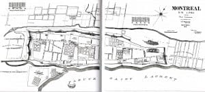 The History of Montreal: The Story of a Great North American City (2007) includes (p. 65) a redrawn version of an older map depicting Montreal as it appeared in 1761, a year after the Capitulation of Montreal. The Capitulation in 1760 occurred subsequent to the Battle of the Plains of Abraham in 1759. The map shows Foubourg (that is, the suburb of) Saint-Laurent north of the fortified walls of the town. The map also shows suburbs to the east and west and the camps of the British occupying forces. The original older map is featured in Opening the Gates of Eighteenth-Century Montreal (1992). Click on the image to enlarge it; click again to enlarge it further.[/caption]
That’s the map, Montreal circa 1761. The blurb under the map says: “The map shows Foubourg (that is, the suburb of) Saint-Laurent north of the fortified walls of the town.”That blurb should not be interpreted to refer to what later became Ville St. Laurent (next to Cartierville); rather, it should be taken to refer to what became St. Laurent Ward (in downtown Montreal). I believe the discussion of St. Laurent Ward you refer to is in your excerpt from the book “The History of Montreal “(2007). I find that discussion replete with misleading suggestions. It mentions a redefinition of the boundaries of Montreal in 1792 so that the Montreal is extended 2 kilometers (obviously north) of the walls. Judging by the width of the Island of Montreal, that 2 kilometer extension would not be enough to include what later became Ville St. Laurent. The discussion mentions (1) “the old town” which would be within the walls of Montreal; (2) the “suburbs”which would be areas shown on the map as Faubourg St. Joseph, Faubourg Quebec and Faubourg St. Laurent (these areas being now a part of downtown Montreal); and (3) “sizeable rural area around them”, which would NOT be so sizeable as to include what later became Ville Saint Laurent [since it was more than 2 kilometers from the walls of Montreal].
The discussion quoted goes to say the “suburbs grew”, “the biggest were the suburbs of Saint-Laurent, Quebec, and Saint-Joseph”and “ in 1831 the government divided THE AREA into WARDS”. This should not be interpreted to mean that THE AREA included what later became Ville St. Laurent.
The quoted discussion continues: “As of 1845, Montreal had nine wards: three in the old town (West, Centre, and East) and six elsewhere (Sainte-Anne, Saint-Antoine, Saint-Laurent, Saint-Louis, Saint-Jacques, and Sainte-Marie).”The “Saint Laurent” referred to here is the St.Laurent Ward [Faubourg St. Laurent in 1761], not the municipality of Saint Laurent Parish created on July 1, 1845.
Your note following this discussion mentioning “the early St. Laurent (or Saint-Laurent, or in English: St. Lawrence) suburb north of the original fortified walls should be understood to refer to St. Laurent Ward, not Saint Laurent Parish or Ville Saint Laurent.
Your note preceding the discussion mentioning “the distinction between Saint-Laurent (the suburb) and Saint-Laurent (the ward)”can be misleading if “Saint- Laurent (the suburb) is understood to refer to Ville Saint Laurent of Saint Laurent Parish. Saint Laurent (the suburb) in the context of the discussion in the 2007 book about Montreal refers to what became Saint Laurent Ward.
Before there was the TMR train station, there was the Portal Heights train station just north of the tunnel. I remember in the 50s and ’60s the train often NOT stopping at Portal Heights but stopping at TMR, a short distance to the north of Portal Heights.