July 2013 newsletter features an update regarding the Lakeview Waterfront Connection Project
The following text is based upon a July 2013 supplementary newsletter of the Lakeview Waterfront Connection Project, which I picked up on an August 5, 2013 visit to an Information Display about the project.
Community consultations
I’ve followed many stories involving community consultation in recent years. One can think of a continuum.
At one end of the continuum is a community consultation that is strong on rhetoric – but that in the long run demonstrates that the organizers of the consultations do whatever they please.
At the other end of the continuum is a community consultation that is based on high-quality, user-friendly communication – and that demonstrates on an ongoing basis that community input has a direct impact on the planning process.
The Lakeview Waterfront Connection (LWC) Project is in the second-mentioned end of the continuum.
I am consequently impressed and inspired and, for that reason, I’m occasionally taking time away from my current work, which involves video editing of several ongoing projects, to devote time to updates regarding the LWC Project.
Sentences in square brackets are my own additional comments
The Lakeview Waterfront Connection Project is organized by
(a) the Region of Peel and
(b) Credit Valley Conservation with assistance from
(c) Toronto and Region Conservation and
(d) the City of Mississauga.
The sand beach west of Etobicoke Creek is in the City of Toronto
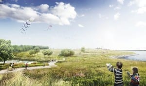
The project will create new parklands along the eastern Mississauga waterfront.
[It’s useful to note, with regard to the eastern Mississauga waterfront, that the sand beach between Applewood Creek and Etobicoke Creek is within the boundaries of the City of Toronto.
[This is a counterintuitive detail that participants at the May 2012 and May 2013 Jane’s Walk in Long Branch found of particular interest.
[It’s easy to intuitively assume – erroneously, as it turns out – that the current channelized (straightened) version of the mouth of Etobicoke Creek serves as the municipal boundary, south of Lake Shore Blvd. West, between Mississauga and Toronto.
Details about where the Mississauga-Toronto boundary is actually located, based on where the western and southern branches of the creek used to run, south of Lake Shore Blvd. West, can be found at a previous post. Additional background about the history of Etobicoke Creek can be found here.]
New coastal wetlands
The project seeks to
(a) establish new coastal wetlands,
(b) improve nearshore and terrestrial habitats, and
(c) provide public access to the waterfront.
Clean fill
The Lakeview Waterfront Connection Project will coordinate with other Region of Peel infrastructure projects in order to maximize reuse of locally generated landfill.
Possibly the project will also coordinate with other local government infrastructure projects with regard to reuse of landfill.
The project is the first one arising through the City of Mississauga’s 2010-2011 Inspiration Lakeview visioning process. [The link in the previous sentence provides a quick overview, from Councillor Jim Tovey’s website, of the Lakeview Inspiration planning initiative. Click here to access the Lakeview Inspiration website directly.]
Key elements
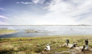
The projects seeks to naturalize a section of the Lake Ontario shoreline. Parkland will extend into Lake Ontario, providing views of the Toronto skyline, and will connect sections of the Mississauga and Toronto waterfront trails.
Sand beach
The project envisions the application of up to two million cubic metres of clean fill material to build up an area extending southeast into Lake Ontario.
The portion of the Marie Curtis Park sand beach that extends west of Etobicoke Creek will, according to the planned design, “transition westward from sands, to pebbles, to small cobbles, then larger cobbles.”
“Three rocky islands,” the July 2013 supplementary newsletter notes, “will be built to absorb the heavy wave action from the lake and allow for calmer waters along the new beach. The new beach will be designed to allow beach materials to move around while withstanding the strong waves that would occur during large storm events.”


Leave a Reply
Want to join the discussion?Feel free to contribute!