Image of Long Branch Hotel
As noted in a previous post, on one occasion I mistook a photo of the Eastwood Park Hotel for the Long Branch Hotel.
I recently came across a copy of Villages of Etobicoke (1985), which features an image of the hotel. It’s an interesting book but when it comes to dates and details, I wouldn’t view the book as a consistently authoritative source.
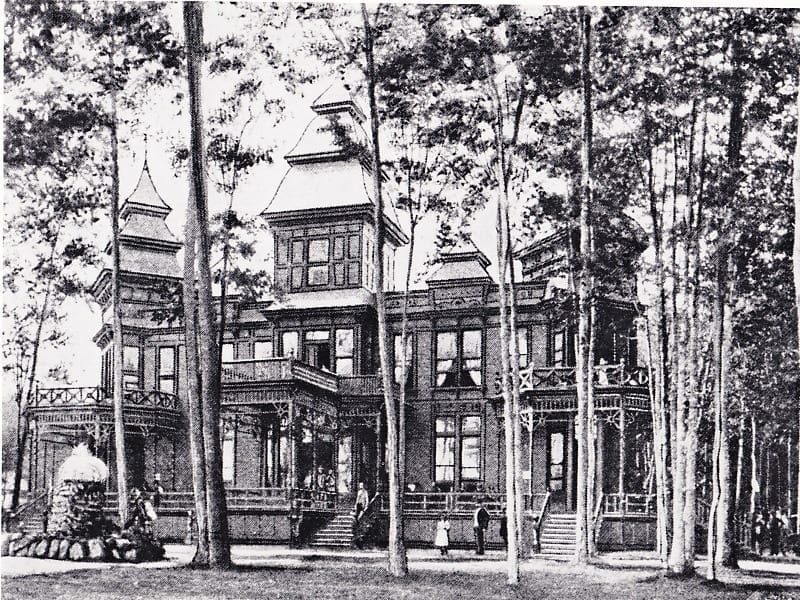
Archival photo of Long Branch Hotel. The image has been scanned from Villages of Etobicoke (1985).

Long Branch Hotel map. Bill Rawson, May 2013
After the May 6, 2012 Jane’s Walk in Long Branch, I was pleased to meet Bill Rawson of Oakville, who has a used furniture store on the south side of Lake Shore Blvd. West near Thirty Third Street.
In preparation for the May 4, 2013 Jane’s Walk in Long Branch, I asked Bill, who grew up near the Long Branch Hotel, to draw a map (see above) of the area. We distributed the map as one of the handouts on our walk. You can click on the maps to enlarge them. Use the ‘Back’ button on your browser to return to the page you are now reading.

A map from the Long Branch Historical Society shows the shoreline of Lake Ontario as it existed during the years before the Long Branch Hotel burned down.
From time to time, I’ve met people who speak about the pier that used to extend into Lake Ontario near the Long Branch Hotel. An interesting feature of the structure is that it extended a distance north of the current shoreline in the area. As a map above indicates, the shoreline was extended to the south in the years after the hotel burned down in 1958 (not in 1954, as some sources erroneously indicate).

Trippers leaving the steamer at Long Branch Pier. This archival image appears in Villages of Etobicoke (1985).
Leave a Reply
Want to join the discussion?Feel free to contribute!