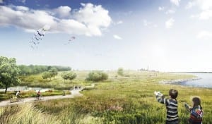
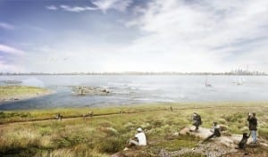
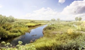
The Lakeview Waterfront Connection Project will connect the eastern pier of the Ontario Power Generation property with new parklands
In a previous post, I described content from the first half of the July 2013 supplementary newsletter of the Lakeview Waterfront Connection Environmental Assessment project.
The newsletter is laid out in a two-column format, which enhances readability. You can view the newsletter here.
I had picked up a copy of the newsletter at an August 5, 2013 Information Display at Marie Curtis Park.
The information displays are part of a the community engagement process connected with the project.
In the earlier post about the newsletter, I shared a couple of images from the project. These are also included as the first two images (Image 1 and Image 3) in the current post.
You can view the renderings here.
You can find more information about the Lakeview Waterfront Connection Environmental Assessment project here.
Applewood Creek
The border, as it exists at the Lake Ontario shoreline, is located just west of Applewood Creek.
The above-mentioned July 2013 supplementary newsletter of the Lakeview Waterfront Connection Project notes that two creeks currently discharge into Lake Ontario within the immediate project area.
To the west is Applewood Creek, located between the sand beach at Marie Curtis Park (also known as the Marie Curtis Park West Beach) and the Region of Peel G. E. Booth (Lakeview) Wastewater Treatment Facility.
Between Applewood Creek and Etobicoke Creek is Serson Creek, whose name I did not know when I was researching the May 2013 South Long Branch Jane’s Walk. I’m really pleased to know the name. From the July 2013 newsletter I’ve also learned that Serson Creek has two outlets.
In research for the Jane’s Walk on May 4, 2013 and May 5, 2013 in Long Branch, I got to know the Serson Creek area quite well. I learned from long-time Long Branch resident Doreen Durance that summer cottages used to be located along the creek, in an area north of where a bike path currently runs.
I was also interested to learn from Doreen Durance that several tall trees that served as landmarks for the cottage community in the area in the 1940s remain standing. It was a delight to learn about the trees.
An area once known as a major Lake Ontario wildlife habitat and scenic beauty location
The wooded area alongside Serson Creek north of the bike path retains a cottage-country ambience even now. It’s not hard to picture, in one’s mind, what the area was like during the 1940s – and still earlier, when the mouth of Etobicoke Creek was known as a “major wildlife habitat and scenic beauty location.”
I find it easy to picture what the Etobicoke Creek mouth looked like before industrialization and settlement occurred in the area. In my case, that is easy because in the early 1970s I spent six weeks living at the edge of a rainforest on the eastern shoreline of Haida Gwaii off British Columbia’s north coast south of Alaska. It was a shoreline where you could walk for kilometre after kilometre without seeing almost anything but the all-encompassing presence of nature.
The experience of walking along endless beaches separating vast expanses of forests and vast expanses of water gives rise to imagery that can stay with a person for a lifetime. At the time, I thought: “This vast and powerful vision is what the Earth was like before the Industrial Revolution came along.”
As an earlier post (which you can access at the link in the previous sentence) notes, the mouth of Etobicoke Creek has also been characterized in a 2001 overview as a wildlife habitat and scenic location that “has been polluted and engineered out of existence.” In that respect, according to the 2001 text, the area serves as a “textbook illustration of the damage done by human interference.”
Human habitation in the area goes back about 10,000 years starting with arrival of Palaeo-Indian nomadic hunters in the area at the end of the last Ice Age.
It’s my understanding that the current project seeks to address the effects of pollution and to bring back some measure of the area’s wildlife habitat and scenic beauty.
Serson Creek has two outlets
The July 2012 supplementary newsletter notes that the first outlet for Serson Creek “allows baseflows to discharge from a perched culvert from underneath the [G. E. Booth Wastewater Treatment Facility]; while the second outlet is through a stormwater channel located between the [G. E. Booth Facility] and the [Ontario Power Generation property].”
I look forward to learning what this text means in non-technical language, so that I can better picture the location and function of the two outlets.
The newsletter notes that low flows in Serson Creek will in future be rerouted down the above-noted stormwater channel. The Lakeview Waterfront Connection Project will also “direct flows from Serson and Applewood Creeks along two new coastal wetlands before the creeks enter Lake Ontario. These wetlands will provide essential wildlife habitat, especially for migrating birds and fish.”
The newsletter adds that most of the new park will consist of rolling meadow habitat, along with pockets of forest and wooded wetlands. A large mound between two wetlands will provide views of both Mississauga and Toronto.
The park’s design and mix of features is the result of extensive public consultation, the newsletter notes.


Leave a Reply
Want to join the discussion?Feel free to contribute!