‘Beach’ plans for the Lakeview – and Long Branch – side of Marie Curtis Park
Update: This topic is also discussed in another blog post. It’s also discussed at this blog post highlighting comments from David Switzer of Long Branch.
I didn’t have the opportunity to attend the recent consultation about the Lakeview Waterfront Connection Project Environmental Assessment in Mississauga.
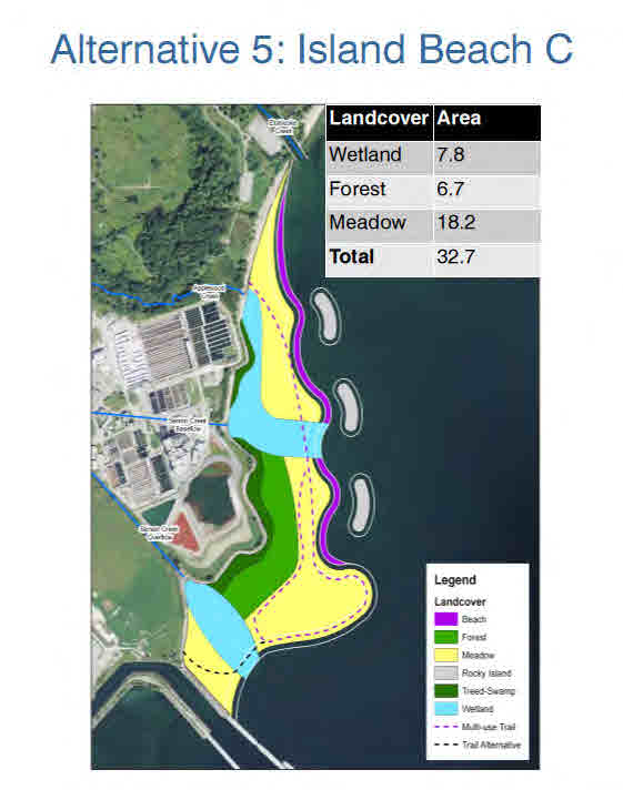
It’s my understanding, however, that one of the options would involve the removal of the sand beach on the west side of Etobicoke Creek in Marie Curtis Park followed by a replacement featuring a shoreline protected by boulders which is characterized as a ‘beach’ in the proposal.
Residents of Long Branch may not have known that the Lakeview plans include, as I understand, the part of Marie Curtis Park that is on the Toronto side of the Mississauga-Toronto border.
Lakeview Waterfront Connection
The relevant information can be found at the Lakeview Waterfront Connection website.
The PDF file that describes the ‘beach’ features can be accessed by clicking on a Poster Displays link at the above-noted website, or you can access the file by clicking below:
The first two of the three images below are from the above-mentioned PDF file. The third image is a schematic representation I prepared a year ago; it indicates the location of the Mississauga-Toronto border in the area south of Lakeshore Road East / Lake Shore Blvd. West.


- Marie Curtis Park, before and after

Leave a Reply
Want to join the discussion?Feel free to contribute!