Lakeview Waterfront Connection – Information display at Marie Curtis Park, Aug. 4, 2014, 1:00 pm – 4:00 pm

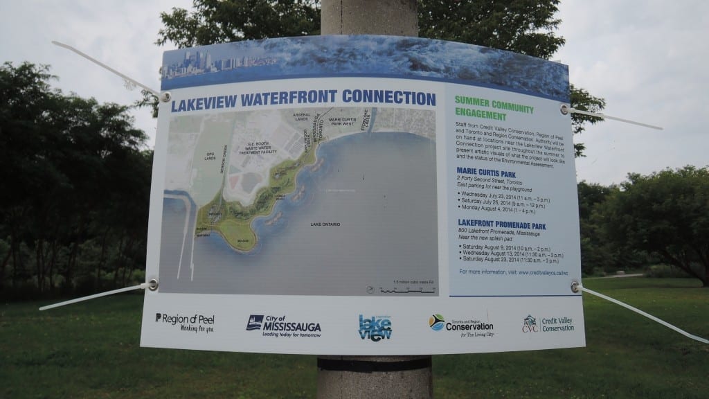
Announcement at Marie Curtis Park concerning public information displays. Click on the image to enlarge it. Click again to enlarge it further.
An earlier post that highlights and provides a context for the Lakeview Waterfront Connection project can be accessed here.
Additional posts related to the redevelopment of the Mississauga waterfront can be accessed here.
Join Credit Valley Conservation, Region of Peel, and Toronto Region Conservation to learn more about the Lakeview Waterfront Connection

A close look at the map enables you to observe the municipal boundary between Mississauga and Toronto along the waterfront. It is located some ways to the west of the current outlet of Etobicoke Creek. When the area was still cottage country prior to Hurricane Hazel (Oct. 15, 1954), the creek used to empty into Lake Ontario at a point near Applewood Creek where the Mississauga-Toronto border is still located. As will be noted from the map, the beach between Etobicoke Creek and Applewood Creek is on the Toronto side of the border.
Staff from Credit Valley Conservation, Region of Peel and Toronto and Region Conservation will be on hand at locations near the Lakeview Waterfront Connection project site throughout the summer of 2014 to present artistic visuals of what the project would look like and discuss the status of the Environmental Assessment.
Marie Curtis Park – east parking lot near the playground:
[Two information days have come and gone; one remains.]
- Monday August 4, 2014 (1 – 4 p.m.)
Lakefront Promenade Park – near the new splash pad:
- Saturday August 9, 2014 (10 a.m. – 2 p.m.)
- Wednesday August 13, 2014 (11:30 a.m. – 3 p.m.)
- Saturday August 23, 2014 (11:30 a.m. – 3 p.m.)

Leave a Reply
Want to join the discussion?Feel free to contribute!